Featured Fragment Blog
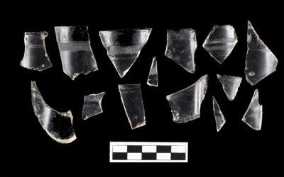
Jelly Juice Jars in Public Schools
By Colleen Betti When you think about artifacts associated with schoolhouses, slate pencils, writing slates, ink bottles, and marbles come to mind. But when I excavated at three 1880s–1950s African American schoolhouse sites in Gloucester County, Virginia for my...
Male Vanity: Just for Men in the 19th Century
By Lee Priddy and Bill Liebeknecht The start of the 19th century saw the transition from powdered wigs as the fashionable hair accessory to flawlessly groomed, short hairstyles for men. The popularity of neatly trimmed hair and facial hair, the preference for brown...
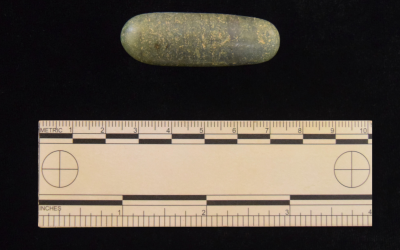
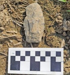
An Unusual Find from Northern New Jersey
,, By Bill Liebeknecht While conducting a controlled Phase I archaeological surface collection of a precontact site in northern New Jersey for a proposed development, an unusual find was discovered: a dense, polished, cylindrical-shaped piece of chiastolite....
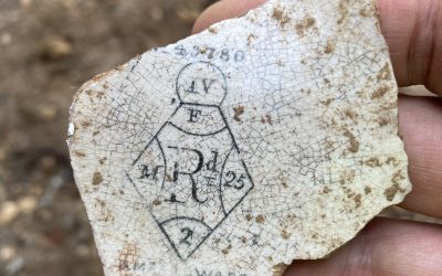
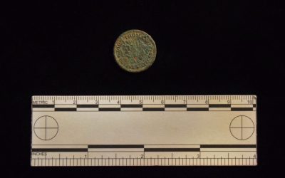
Sometimes Ceramics Are More Helpful Than Coins!
By K. Lee Priddy "When does a specific artifact date from and how do you know?” is one of the most frequent questions that I receive when talking to the public. It allows me to discuss manufacturing dates of ceramics, bottles, and metals and the methods that we use to...
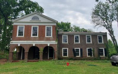
“ On a tree – shaded hill overlooking the Town of Orange … :” The Restoration of Berry Hill
By Casey Squyres, Architectural Historian Dovetailers love their history! Although our blogs usually focus on a neat find from one of our company projects, this post focuses on a passion project of one of our architectural historians, Casey. Kudos to Casey for her...
DIY Currency: It Just Makes Cents
By: Katie Rezendes With war comes shortages ¾ from food and supplies to even physical money. The American Civil War was no exception to this reality. By the second year of the war in 1862, government-issued currency was quickly disappearing as people began to hoard...
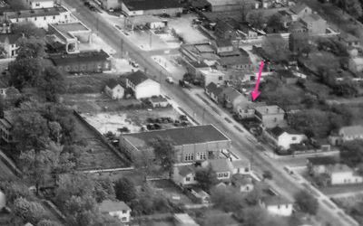
Anything But Boring: An African – American Boarding House in Fredericksburg
By Elyse Adams, Dovetail Lab Manager In March 2022, Dovetail Cultural Resource Group (Dovetail) conducted archival research and a two-day archaeological excavation at 1416 Princess Anne Street in downtown Fredericksburg, Virginia. These combined efforts shed light on...
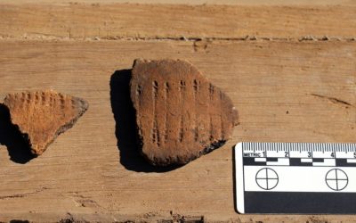
Rocker – Stamped and Dentate – Stamped Pottery
From the Wolfe Neck Shell Midden Sitein Sussex County, Delaware By Bill Liebeknecht In advance of a proposed trail at Cape Henlopen State Park in Sussex County, Delaware, Delaware Department of Natural Resources and Environmental Control hired Dovetail Cultural...
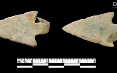
One Foxy Point: A Fox Creek From John Dickinson Plantation
By: Andy Martin This Fox Creek or Selby Bay (if you’re from Virginia) projectile point was recovered from the John Dickinson Plantation in southern Delaware. Why is this extra cool? Fox Creek/Selby Bay projectile points are a relatively common point type that are...
Delaware We Have Contact!: A Copper Alloy Arrowhead from the John Dickinson Plantation
By: Bill Liebeknecht A copper alloy projectile point or “arrowhead” was recently recovered by Dovetail Cultural Resource Group during an archaeological survey at the John Dickinson Plantation near Dover, Delaware. Work was conducted on behalf of the Delaware Division...
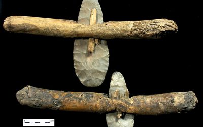
That’s not a knife! This is a knife. Or is it?
By: Andy Martin Today we’re talking about one of the less-discussed pieces of the Native American/pre-contact tool kit…the knife. There has been seemingly endless amounts of ink spilled about projectile points and axes and pottery but believe me (I’ve looked) there’s...
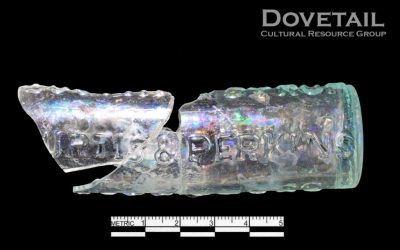
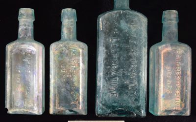
“Poppin’ Medicine Bottles”
Featured Fragment –“Poppin’ Medicine Bottles” By Katie Merli Medicinal, pharmaceutical, and chemical bottles have a distinctive look to them, even today. Informative labels, child-proof closures, and even the well-known “Mr. Yuk” stickers from our youth set these...