South Mountain Battlefield Study
Frederick and Washington Counties, Maryland
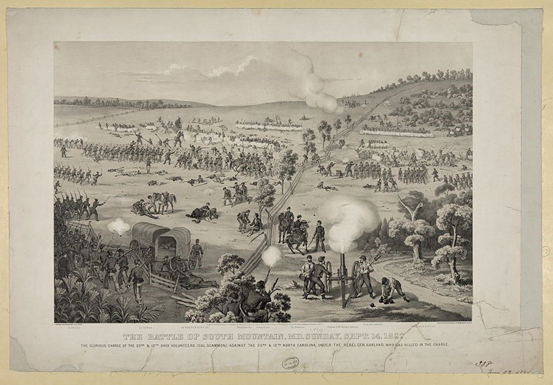
As part of the Maryland Department of Transportation State Highways Administration (MDOT SHA) research series, Dovetail worked with state archaeologists and other specialists to record three historic properties in northwestern Maryland: Arnold Farm, Shafer Farm, and Fox’s Gap. All three have an association with the 1862 Battle of South Mountain, part of the Maryland Campaign during the United States Civil War. Dovetail’s work involved:
- Phase I archaeology
- Controlled metal detecting
- Artifact analysis
- Architectural evaluations
- Battlefield landscape analysis
- Remote sensing
- Dendrochronology analysis
- Archival research
- Development of interpretive signage
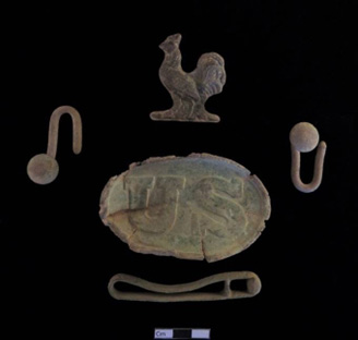
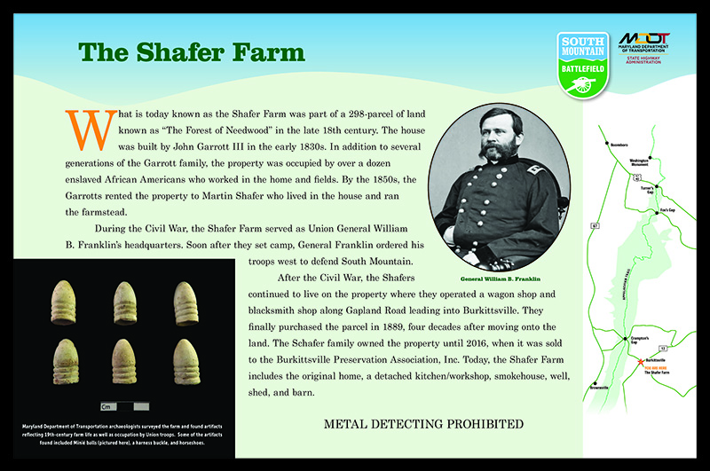
The Arnold Farm was first occupied during the 1790s. The artifacts recovered during this study reflect an occupation period commencing near the turn of the century through the mid-nineteenth century. The metal detector survey on the Arnold property recovered numerous artifacts associated with encampments and the Battle of South Mountain, confirming the positions of the Union and Confederate armies during this engagement. The Shafer Farm is an early-nineteenth- to mid-twentieth-century farmstead with an extant dwelling, barn, well, detached kitchen/workshop, and dairy. The metal detector survey produced very little cultural material related to the Civil War use of the property due to the short duration of troop occupation on this land and heavy metal detecting by hobbyists over the years. Studies at Fox’s Gap consisted of mapping extant landscape features and a controlled metal detection survey. The results indicate that this parcel was repeatedly traversed on the day of the battle, which partially obscured clear and defined battle lines, but the information does illuminate troop positions, potential lines of fire, concealment, and key terrain elements.
This project reflects Dovetail’s knowledge of battle-related studies through the employment of appropriate field methodologies, the interpretation of complex war landscapes, and the analysis of combat artifacts. The project also involved the presentation of these findings to the public. All studies were coordinated with the MDOT SHA and several non-profit groups to assure that the signage was accurate and appropriate.